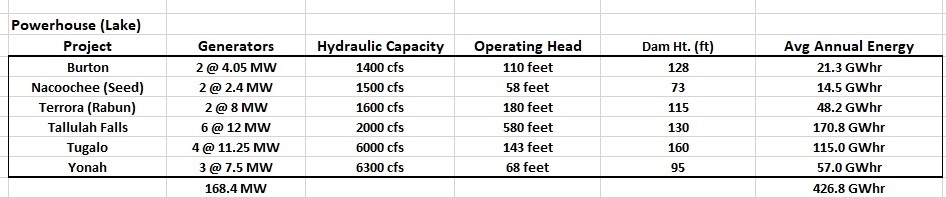
The following table presents pertinent information about the six hydropower projects in the system. The first column is the project name, followed by the number of generators with capacities. The third column is the hydraulic capacity of the project in cfs. This column is referred to as "Q" in the Power Equation. The next column is the Operating Head (h). The fifth column is the height of the dam. And the final column is the average annual energy. This final column was obtained from an Environmental Impact Statement (EIS) by the US Federal Energy Commission.
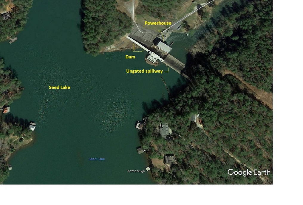
The traditional location of a hydro powerhouse is immediately below the dam, connected to the dam as is shown in this aerial photograph from Google Earth of Seed Lake and Nacoochee Dam and power plant. In this arrangement, the dam height is typically 15-30 percent greater than the hydraulic head (h). And in the above table, one can see that is the case for the projects at Burton, Seed, Tugalo and Yonah.
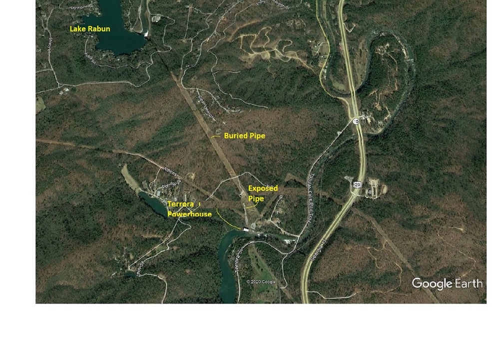
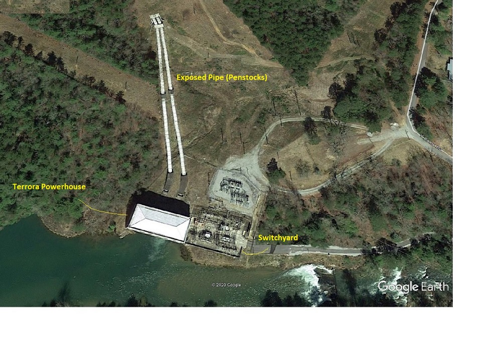
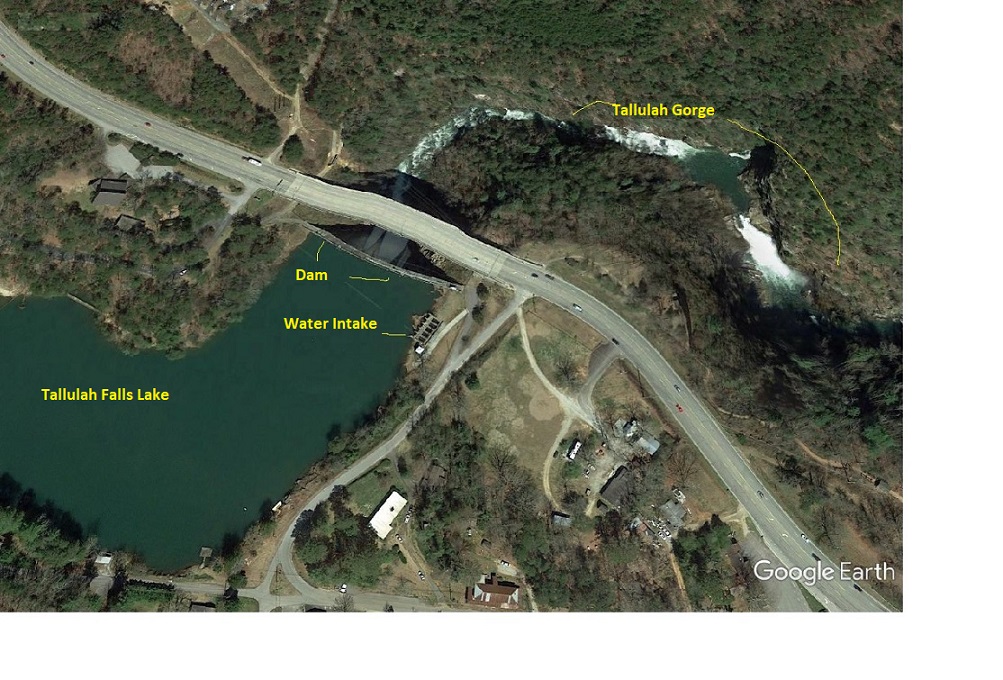
In the above table, you will see that the Rabun (Terrora) and Tallulah Falls Projects violate this rule of thumb that the powerhouse is physically close to the dam because the head is much greater than the height of the dam. At Rabun (Terrora) the operating head is 65 feet greater than the dam height and at Tallulah Falls it is 450 feet greater than the dam height. The reason for this is that the power plants for both of these projects are located a considerable distance away from the dam (and down hill - topography again), and connected via large pipes (penstocks). (as shown in the following pictures)
Rabun Lake and Terrora Powerhouse
Terrora Powerhouse with Penstocks immediately above the powerhouse
Tallulah Falls Lake, Dam and Water Intake for Powerhouse
Tallulah Falls Lake with Water Intake, Gorge and Powerhouse (over one mile downstream from lake)
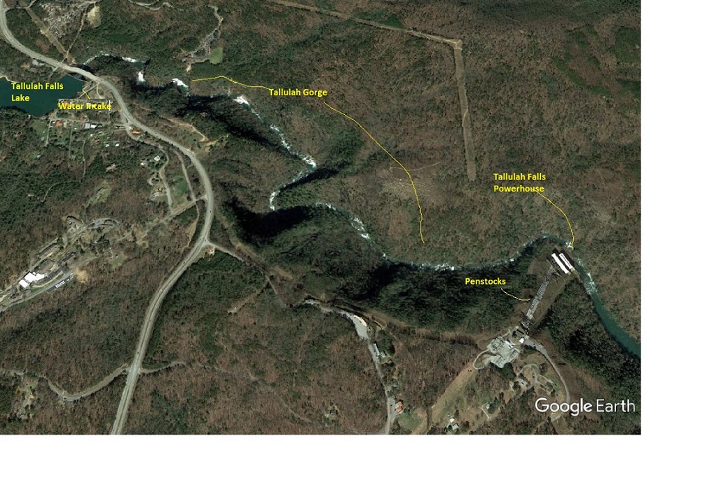
Tallulah Falls Powerhouse with Penstocks
